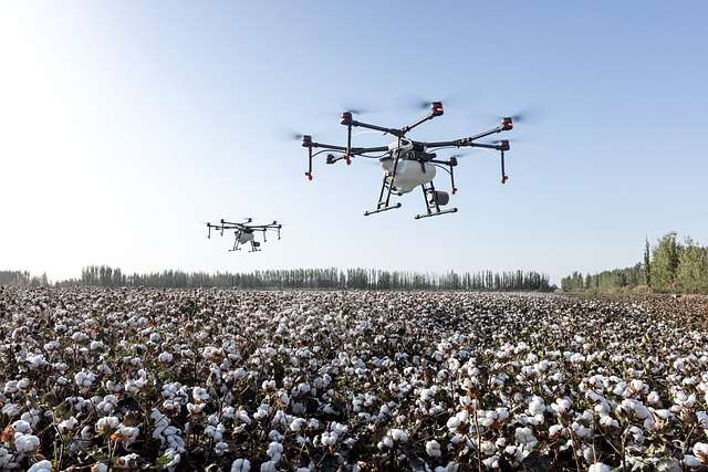
Agriculture Drones: Precision Farming Solution
In the modern world, farming plays a crucial role in the economy of many countries. To help farmers overcome challenges and enhance their productivity, the Drone offers innovative solutions and features. With unrestricted remote access, farmers can effortlessly monitor their field areas, streamlining agriculture processes and making farming more efficient and cost-effective through the use of farm drones.
Monitor and Map Plant Health
Drones, equipped with cutting-edge technology to detect the near-infrared reflectance of plants using overlays generated by both conventional RGB cameras (VARI) and multispectral camera systems. This advanced capability allows the drone to identify early plant stress that is invisible to the naked eye, enabling timely interventions to boost crop health and maximize harvest yields.
Isolate Diseased Crops
Drones takes precision agriculture to the next level by generating comprehensive maps to pinpoint affected areas and prevent the spread of diseases to healthy plants. This advanced UAV goes beyond NDVI-based plant health calculations by incorporating multispectral data collection and (AI) machine learning algorithms to detect disease infected plants. Its cutting-edge technology ensures timely and accurate categorization of specific plant diseases, allowing for targeted intervention.
Plant Counting in Farm and Agriculture plantation
Drones boasts state-of-the-art deep learning AI, meticulously programmed to identify and count specific plant species. This groundbreaking technology enables managers and farmers to conduct precise plant and weed measurements, closely monitor plant growth, and implement strategies to optimize harvest yields. By harnessing the power of Drone’s advanced AI capabilities, agricultural professionals can achieve unprecedented levels of accuracy and efficiency in their farming practices, leading to increased productivity and improved crop management.
Maps Interaction
Drone’s farm drones provide interactive farm maps with image-based intelligence, optimizing task organization and simplifying spraying capabilities. They enable data-driven decision-making, leading to enhanced crop yields and increased farm productivity.
Create Surface Models
Enhance your irrigated agriculture decisions by utilizing efficient surface models that accurately track the 3D topography of your field. By understanding the flow of water, you can make informed judgments about irrigation, ensuring optimal water distribution and maximizing crop yield. These advanced surface models provide valuable insights into your field’s terrain, helping you optimize irrigation practices and improve overall agricultural productivity
We also provide the following other drone and geo packages:
- Topographic Surveys with Contour Lines and Elevation Models
- Boundary, As-built, GPS, and Cross Section Survey
- Volumetric and Distance Measurements
- Building Information Models
- Drone Pilot and Operator Training
How are drones used in agriculture and farming?
Unmanned aerial vehicles (UAVs) allow for unprecedented levels of control when it comes to managing crops and farmland.
For example, drones can rapidly survey up to 200 hectares in a day and return with high resolution imagery to monitor the growth and health of crops and soil over time. This is particularly important to quickly assess damage caused by typhoons, floods, and parasites.
Drones also aid in agriculture planning by identifying slopes and elevation in the property, along with possible irrigation paths, to find the most suitable planting areas. GPS locations are always recorded and can be used to directly measure the size of plots for different uses.
All these uses and more are enabled by the different sensors equipped on drones. These range from photogrammetry sensors that can photograph and video any property in extreme detail, to multispectral cameras that measure the amount of near infrared light reflected by chlorophyll in plants to assess their health.
What are the benefits of UAVs in agriculture?
Agriculture is one of the newest industries that have been transformed by modern drone technology, for many reasons.
Quickly gather large amounts of data in a short time
Drones can cover and collect data from hundreds of hectares of agricultural land within a few hours – much faster than other traditional survey methods. This speed is extremely important when you need to find out the amount of damage caused by floods, or whenever you need to make a decision on when and where to plant.
Survey hard to reach terrain
Unmanned aerial vehicles (UAVs) are not limited by the type or accessibility of terrain. They can be sent to survey properties that would be dangerous or very time-consuming to survey on the ground such as extreme slopes or cliffs and mountainous areas.
Wide range of agricultural applications
Drones can be equipped with sensors to gather data for any purpose. This includes monitoring the health and growth rates of crops, finding differences in the amount of moisture in the soil, and making measurements for distance, volume, and number.
Make reliable and accurate measurements
All measurements done by drones are highly reliable and backed up by robust data. Surveys and imagery can be done to the centimeter level in high resolution to easily spot differences.